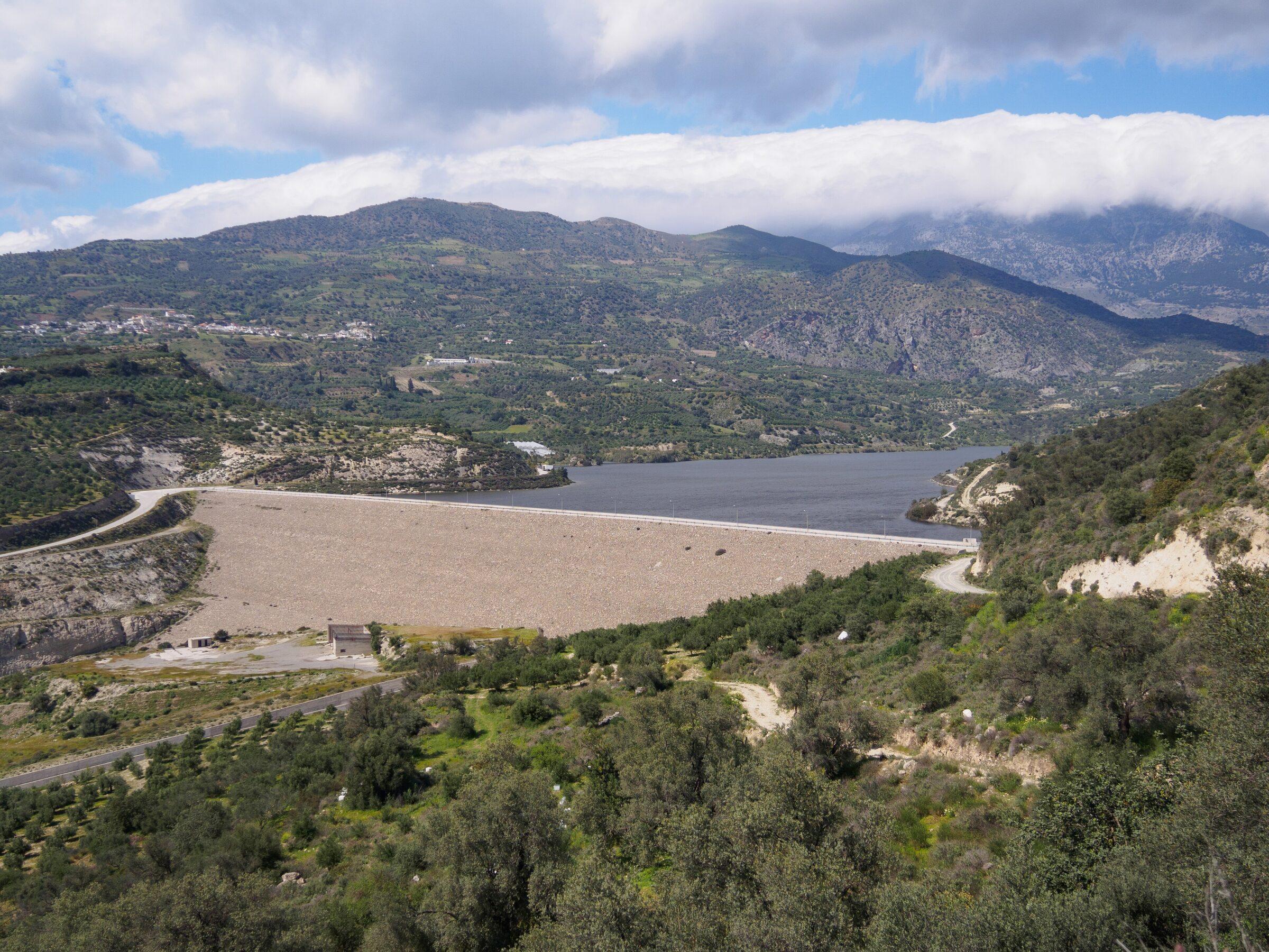
Photo: C messier · CC BY-SA 4.0
The Faneromeni reservoir lies in a green valley at the southern foot of Psiloritis, on the edge of the village of Faneromeni, about 7 km west of Zaros and 7 km north of Tymbaki. Built to water the olive groves and vegetables of the Messara plain, it has become a wetland in its own right.
How it formed
The lake was made in 2005, mainly from the Koutsoulidis river, which gathers water from the Rouvas forest. Its level varies widely: in the drought of 2024 it fell very low, with a state of emergency declared in the Messara and illegal pumping also blamed, and in spring 2026 it recorded its highest level in several years.
Nature
Because it holds water all year, water plants and lakeside vegetation have grown up around it, and various birds and other animals now live here.
Visit
Swimming
No reliable information
Tips
The main way in is through Vori, near Phaestos, on a signposted road; you can also come through Galia or Zaros. A walk around the dam and the abandoned village of Laloumas on its banks is especially good in spring.
Phaestos palace is about 6 km away, and the Museum of Cretan Ethnology and the Kardiotissa monastery at Vori are also close. The gorges of Rizopetro and Apolychnos and the Kamares–Zaros trail are good for walkers.
Nearby lakes
Show on map


Know Faneromeni Reservoir well?
Suggest a beach, viewpoint, trail or amenity, or tell us if something has changed. We read every message.
Sources & data
- Greece's 2022 Water Framework Directive reporting to the EEA: lake (LW) and transitional (TW) water bodies, field cArea, European Environment Agency (WISE WFD), reported by Greece, 2022
- OpenStreetMap: Τεχνητή Λίμνη Φανερωμένης (relation 2368659), OpenStreetMap contributors
- Wikidata: Phaneromeni reservoir (Q97202572), Wikimedia Foundation
- Faneromeni dam lake, Cretan Beaches
- Faneromeni dam, This Is Crete
- Crete’s Messara struggles with water shortage (2024), Euronews
- Faneromeni dam water levels (2026), Argophilia