Lake Kastraki is a reservoir of about 28 km² on the Acheloos near the village of Kastraki in Aetolia-Acarnania, at the junction with the Inachos, reaching to Bampalio in the north-west. Its islands, the churches near its shores and the hills around make a quiet landscape.
How it formed
The Kastraki dam, 95 m high and 530 m long, was completed in 1969. It generates hydroelectric power for the Public Power Corporation, and flooded farmland and small settlements in the Acheloos valley.
Visit
Swimming
No reliable information
Tips
The lake is about 12 km from the Agrinio–Arta national road, and Agrinio is the nearest town. Local roads give views over the water; ask in Agrinio about access to the shore.
Nearby lakes
Show on map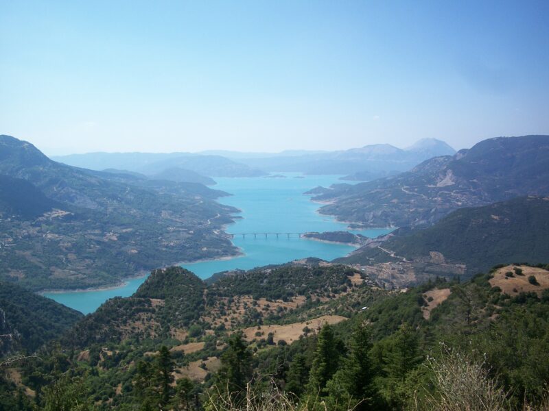 Photo: C messier · CC BY-SA 3.0

Greece · Central Greece · Western Greece
Lake Kremasta
Reservoir · artificial
~20 kmaway
300 metreselevation
Know Lake Kastraki well?
Suggest a beach, viewpoint, trail or amenity, or tell us if something has changed. We read every message.
Sources & data
- Greece's 2022 Water Framework Directive reporting to the EEA: lake (LW) and transitional (TW) water bodies, field cArea, European Environment Agency (WISE WFD), reported by Greece, 2022
- OpenStreetMap: Τεχνητή Λίμνη Καστρακίου (relation 7778004), OpenStreetMap contributors
- English Wikipedia: Kastraki (lake), Wikimedia Foundation
- Wikidata: Kastraki lake (Q1365911), Wikimedia Foundation
- Lake Kastraki, Lakes Network