 Photo: BuhaM · CC BY-SA 4.0

Montenegro · Northern Montenegro · Prokletije
Bukumirsko jezero
Glacial · natural
~5.5 kmaway
1,448 metreselevation
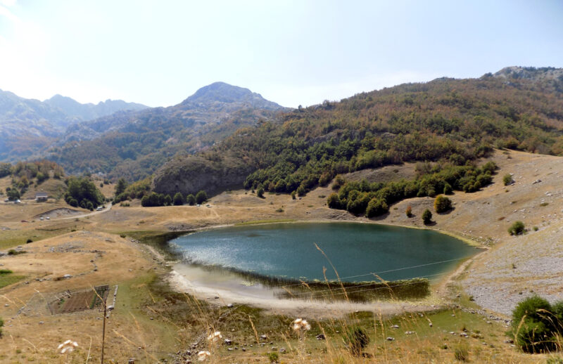
Rikavačko jezero is a glacial lake in the Kuči mountains, between the Širokar plateau and Mount Vila, a few hundred metres from the Albanian border. Rikavac katun, a summer settlement of shepherds’ huts and a growing number of weekend houses, lies nearby, without electricity or mobile signal.
The Rikavac stream feeds the lake, and its water sinks away towards the rivers Cijevna and Ribnica.
No reliable information
The lake is about 50 km from Podgorica through Kuči. The paved road ends at Mokra, and the last stretch is rough gravel for 4×4s, mountain bikers and hikers only; jeep tours run up here, so a guide is a good idea if you have no suitable vehicle.
There is no electricity or mobile signal at the katun, so bring what you need, and be ready for fog, which can come down quickly and hide the views.
Photo: BuhaM · CC BY-SA 4.0Montenegro · Northern Montenegro · Prokletije
Glacial · natural
Montenegro · Northern Montenegro · Prokletije
Glacial · natural
 Photo: Bruno Rijsman · CC BY 2.0
Montenegro · Northern Montenegro · Prokletije
Glacial · natural
Suggest a beach, viewpoint, trail or amenity, or tell us if something has changed. We read every message.
Thank you. We read every suggestion.
