
 Photo: Georgios Liakopoulos · CC BY-SA 3.0
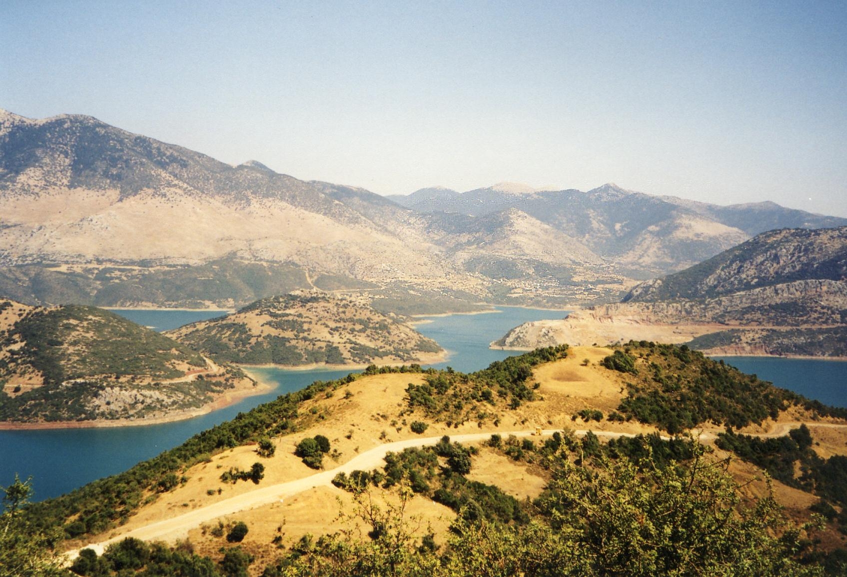
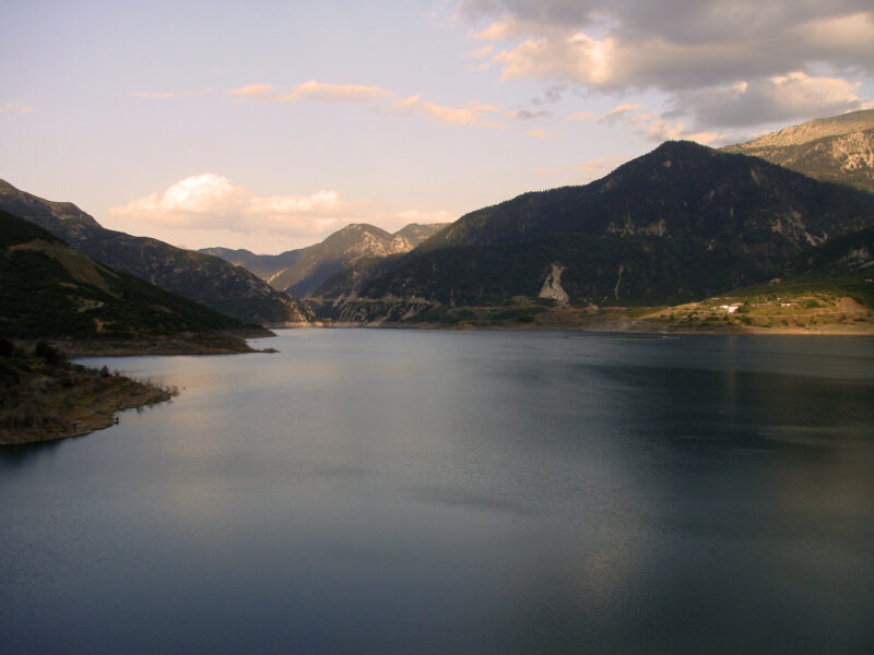
Lake Mornos is an artificial lake in the mountains of Fokida, between Giona and Vardousia, built to meet the growing water needs of Athens. It is roughly X-shaped, with many fjord-like inlets, and lies beneath Lidoriki, the small mountain town known as the “Dorian Switzerland”. Maples, plane trees, willows, strawberry trees and clusters of Greek fir grow on its slopes.
How it formed
The Mornos valley was flooded from 1979, behind an earth embankment dam about 189 m high. An aqueduct of 192 km, one of the longest in Europe, carries the water to Attica, and a tunnel brings more from the Evinos.
The lake’s size changes greatly with the rain and snow. Its surface shrank from about 19 km² in 2022 to under 9 km² in September 2025, the lowest recorded for the time of year.
History
When the water rose it covered the village of Kallio, formerly Velouchovo, with its houses, church and school; the people moved away to a new Kallio higher up, to Lidoriki and to Athens. In droughts the ruins come back into view, as they did in 2024 and 2025. At the Steno, the narrowest point of the lake, where the banks almost touch, an old stone bridge lies under the water.
Nature
Eels, barbel and trout live in the lake, along with Valencia robertae, a rare fish found only in western Greece.
Visit
Getting there
Nearest settlement: Lidoriki
Swimming
No reliable information
Tips
You can walk along the banks or drive along the shore. Kokkino is the only village on the water, with a few tavernas and rooms to let, and Lidoriki is the main base. Fill up with fuel at Lidoriki, as filling stations are few.
The road via Itea and Amfissa is the easier approach. To see the lake from all sides, come from Trikorfo, cross above the bridge at the dam and go round to Lidoriki. Beyond it the road climbs through big firs towards Vardousia and the village of Athanasios Diakos, with its square, lodgings and tavernas, up a stretch of tight bends.
Nearby lakes
Show on mapPhoto: Georgios Liakopoulos · CC BY-SA 3.0
 Photo: Georgikopoulos Manolis · CC BY-SA 4.0

 Photo: EviFast7 · CC BY-SA 4.0

Know Lake Mornos well?
Suggest a beach, viewpoint, trail or amenity, or tell us if something has changed. We read every message.
Sources & data
- Greece's 2022 Water Framework Directive reporting to the EEA: lake (LW) and transitional (TW) water bodies, field cArea, European Environment Agency (WISE WFD), reported by Greece, 2022
- OpenStreetMap: Τεχνητή Λίμνη Μόρνου (relation 2806576), OpenStreetMap contributors
- Greek Wikipedia: Λίμνη Μόρνου, Wikimedia Foundation
- Wikidata: Lake Mornos (Q12880041), Wikimedia Foundation
- A stunning artificial lake hidden among wild mountains: Lake Mornos, All Over Greece
- Lake Mornos has lost half its size to water scarcity (2025), Keep Talking Greece
- Lidoriki and Lake Mornos, Travelfind
- Trip report: around Lake Mornos (2004), Moto Riders Club