Every country has its famous lake, the one on the postcards. This guide is about the others: a lake that has islands which drift with the wind, an island full of tortoises, a church standing in the water, a lake that sometimes turns into a football pitch, and a handful of mountain lakes you can only reach by walking for most of a day. Some are an easy detour. Some take planning. All of them are worth the effort.
Vlasina: the lake with islands that move
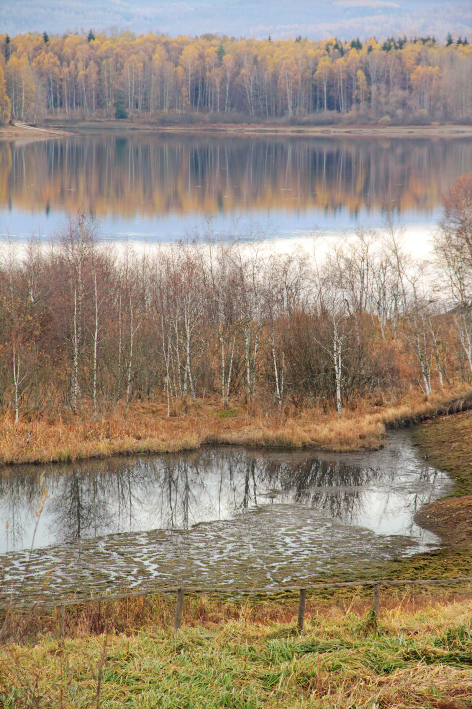
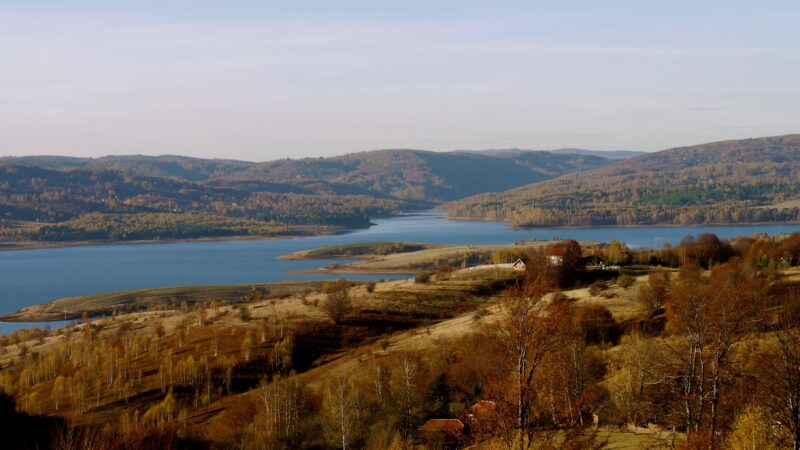
High on a plateau in south-eastern Serbia, at about 1,200 m, Vlasina Lake looks like any other mountain reservoir until you notice that some of the land is moving. It was made between 1947 and 1951 when a dam closed off the peat bog of Vlasinsko Blato, and since 1948 pieces of peat have been breaking loose from the shore at high water and drifting across the lake, pushed around by the wind. They carry grass, shrubs and even small trees, and they are home and shelter to fish, birds and insects.
Nobody agrees on how many there are: about thirty by some counts, closer to ten by others, and the number changes as islands break up, ground against the shore or merge. The biggest is called Mobi Dik, and in winter the ice holds all of them still near the shore. The islands are protected, and landing on one is forbidden, so the way to enjoy them is from the shore with patience and a good pair of binoculars, ideally on a calm morning when the reflections are best.
- What makes it unusual
- Floating islands of peat that drift across the lake.
- Getting there
- Along a road from Surdulica, about 30 minutes away. Public transport is thin, so a car is the practical choice.
- Best time
- March to November; spring and autumn are quieter, and calm mornings give the best photographs.
- Mind this
- Do not land on the islands. Nights can be close to freezing in spring and autumn, so bring layers.
The walk around the lake is about 12 km and takes 4 to 5 hours, mostly flat with some gentle climbs, and short day hikes climb to the grassy ridges of Čemernik and Vardenik for views over the plateau. The trails are poorly marked, so take a map or GPS. Surdulica has hotels and shops, and there are campsites and guesthouses by the lake. Try the local fish stew.
Golem Grad: the island of snakes and tortoises
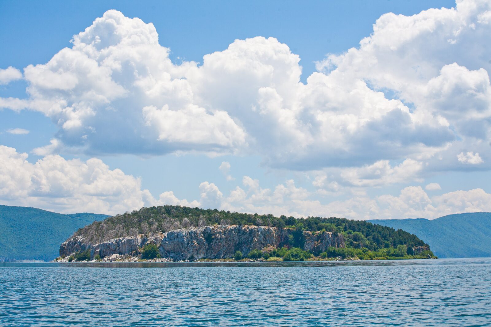
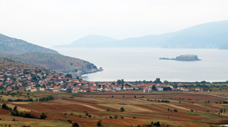
The Macedonian name means Big Town, and the nickname is Snake Island. On a rocky islet of about 20 hectares in the middle of Great Prespa, Lake Prespa, stand the ruins of a 14th-century church of Sts Peter and Paul and of several other old buildings. A small monastic community lived here until the middle of the 20th century, and since then nobody has. The island opened to visitors in August 2008.
The strangest residents are around 1,000 Hermann's tortoises, introduced by people, with roughly 19 males to every female. They share the island with the snakes that gave it its second name, so keep to the paths and watch where you step. You reach it by boat from the village of Konjsko, about 2 km away, and the island belongs to Galičica National Park, so landing rules apply: ask at Resen before you go.
- What makes it unusual
- An uninhabited island with medieval ruins, tortoises and snakes.
- Getting there
- By boat from Konjsko, about 2 km across the water; Resen is the nearest town.
- Best time
- June to August are the most pleasant months on Prespa.
- Mind this
- Check the current landing rules locally. As on all border lakes, check the rules before crossing between countries.
Prespa is worth more than the island. The lake is the highest tectonic lake in the Balkans, and underground channels carry its water through the limestone of Galičica to springs on the shore of Lake Ohrid. On the Greek side, Little Prespa has what is said to be the largest colony of Dalmatian pelicans in the world, and a floating footbridge of about 650 m leads to the islet of Agios Achillios.
Mavrovo: the church in the water
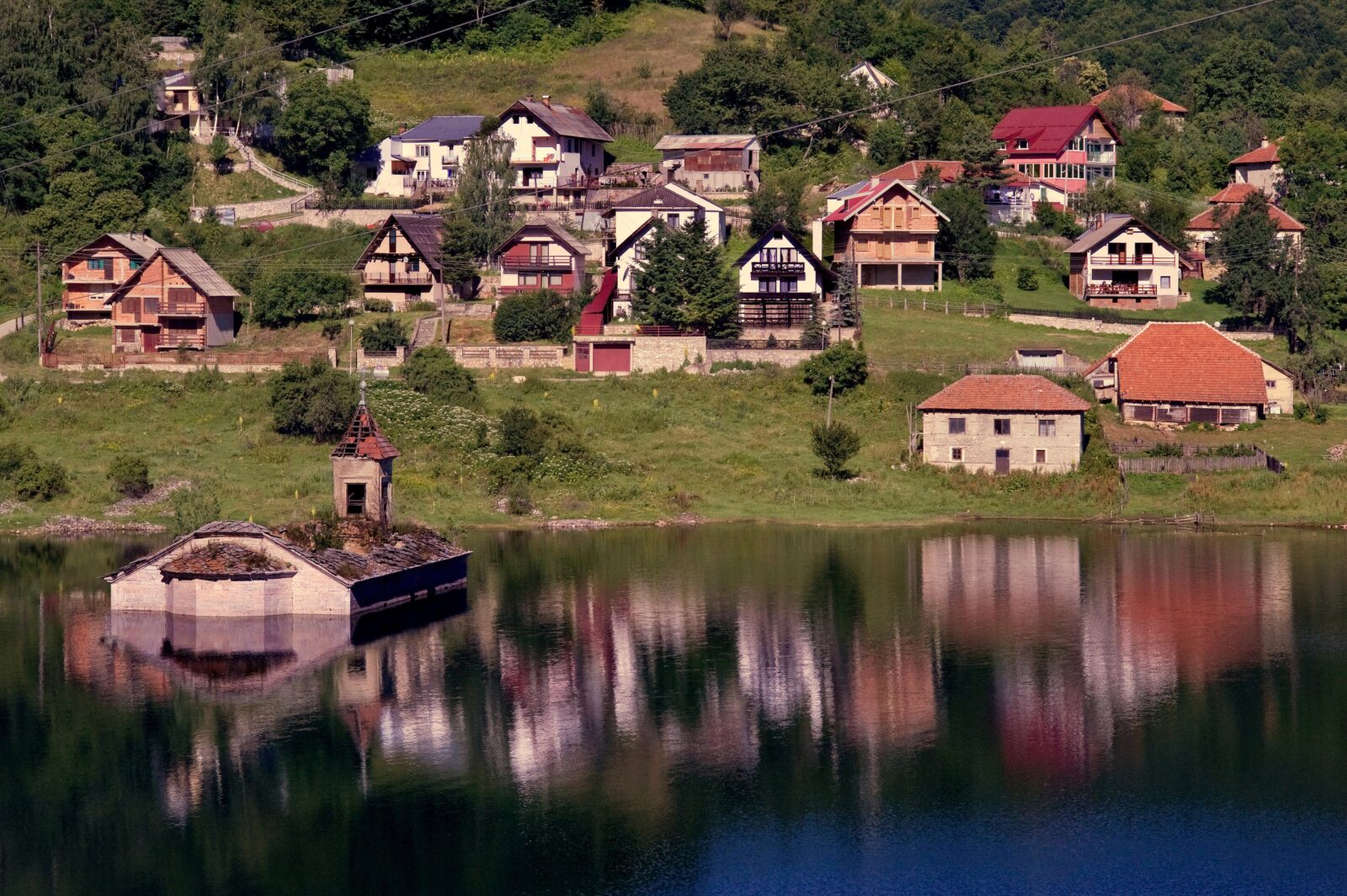
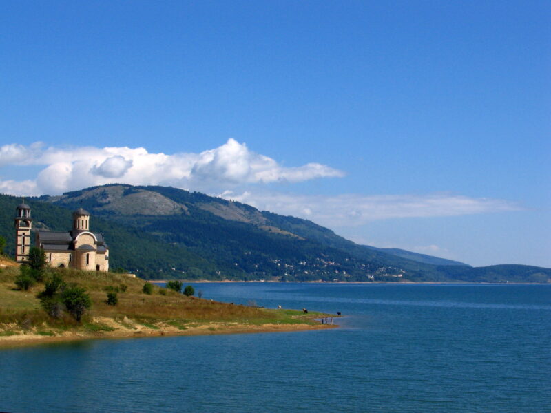
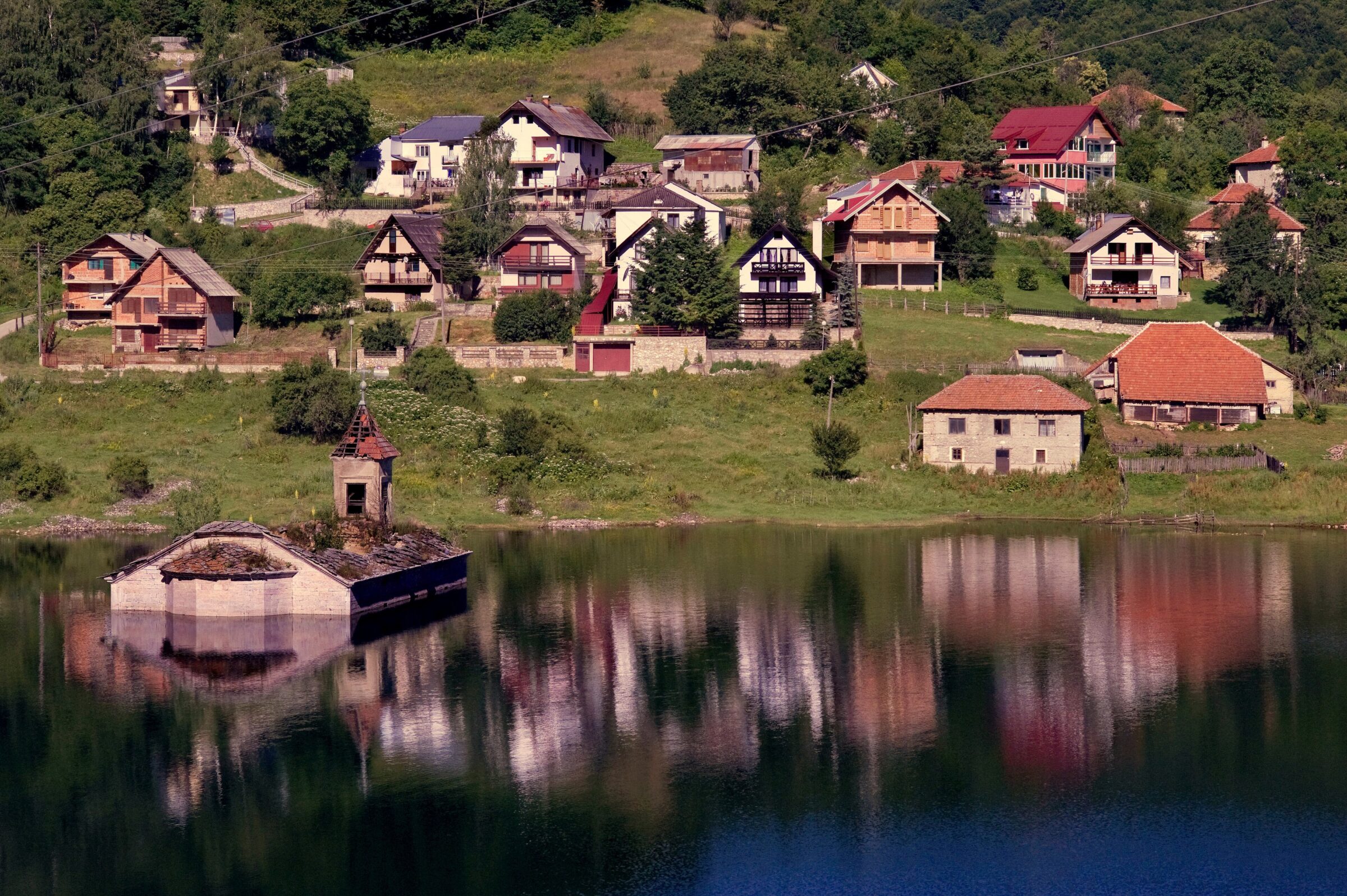
When the valley of the Radika was dammed in 1953, the water rose around the church of St Nicholas and never went away. Built around 1850, with icons attributed to the master Dičo Zograf, it now stands half-submerged, and when the lake is high it seems to float on the surface. The picture has become the symbol of Mavrovo Lake and of Mavrovo National Park.
The church is at its most photogenic when the water is full and the village is reflected in it. In a dry late summer, though, the lake drops and more of the building comes into view, and in a real drought you can walk to it. A newer church of St Nicholas, built in 2006, stands on the shore above. The icons from the old one were moved to a small church on the opposite shore as the water began to rise.
- What makes it unusual
- A 19th-century church standing in a reservoir.
- Getting there
- Within reach of Skopje; the M4 road links Skopje and Ohrid, and a minibus runs between Debar and Skopje.
- Best time
- Summer for swimming and boating; in winter the lake freezes and the ski resort on Bistra opens.
- Mind this
- Water levels change from year to year, so how much of the church you see depends on the season. The national park's rules apply on the shore.
Come in July and you can pair the lake with the Galičnik wedding, a two-day festival on the weekend nearest 12 July where a chosen couple is married in the old way. The Duf waterfall is a half-hour walk through forest, and the monastery of St Jovan Bigorski, with its carved wooden iconostasis, is one of the most important spiritual sites in the country.
Hridsko jezero: the lake of happiness
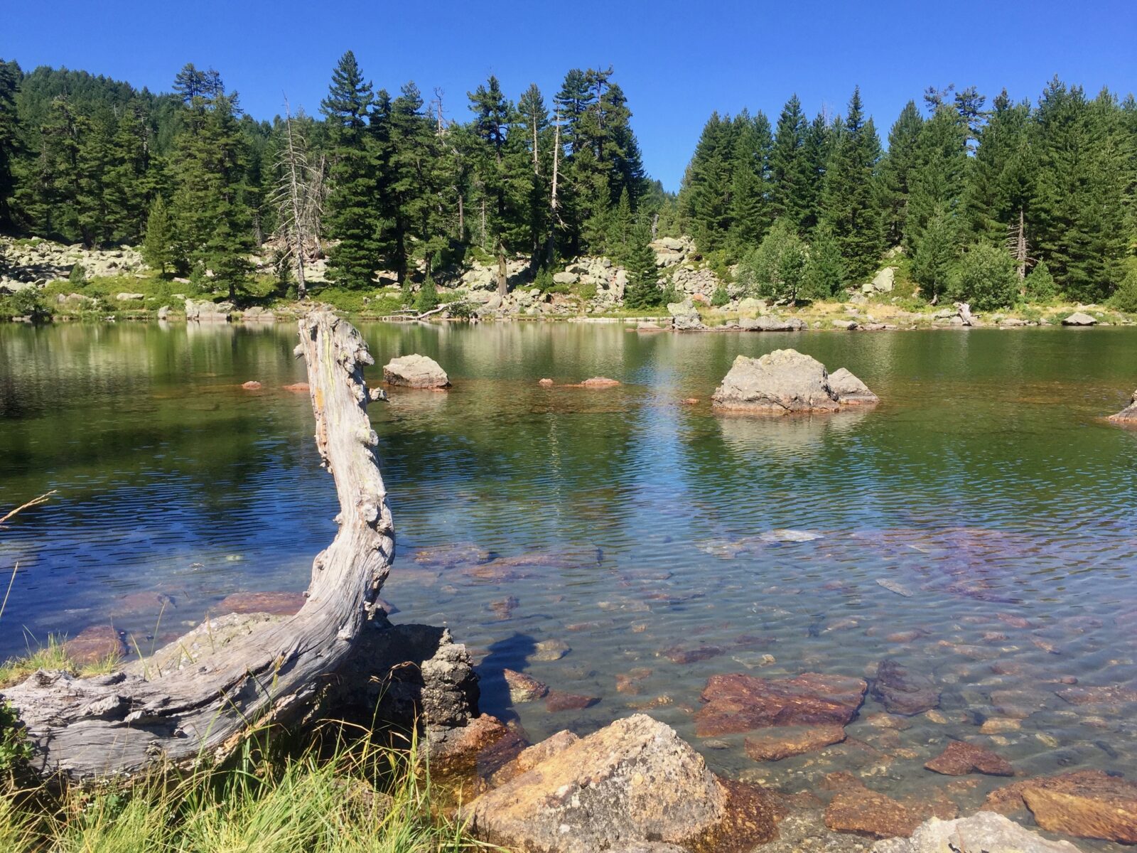
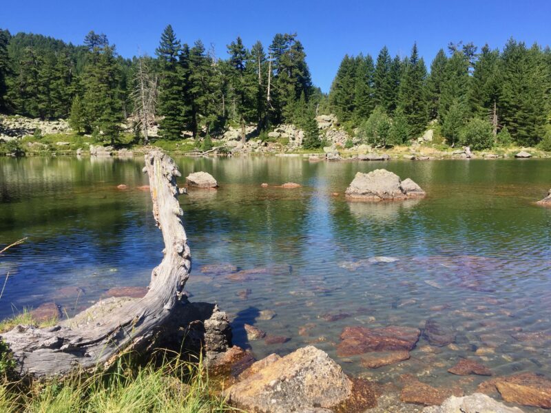
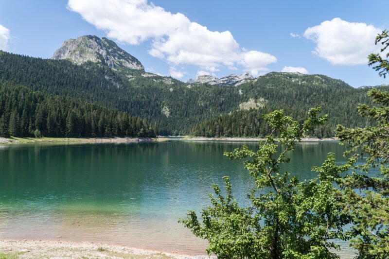
The mountains of Prokletije, the Accursed Mountains, are among the wildest in Europe, and their lakes are hard to reach and well worth it. Hridsko jezero sits at about 2,000 m in a glacial cirque below the cliffs of Hridski krš and Bogićevica in Montenegro. It is small, no more than about 160 m across, and it shrinks in summer, swells with rain and snowmelt and freezes in winter. Locals call it the Pearl of Prokletije and the lake of happiness.
The folklore is part of the charm. Forest fairies are said to have hidden from people and bathed here, and those who swim in the lake are meant to find health and luck in marriage. Visitors still toss a coin or a piece of jewellery into the water and make a wish. The route starts at Babino polje, about 15 km and half an hour from Plav on a road whose last stretch is rough, so a 4×4 is best. From there a dirt track leads to Bajrovica katun, where a shepherds' cottage serves food and has beds in season, and a marked forest path continues to the lake: about 8 km there and back.
- What makes it unusual
- A high glacial lake of folklore, whose size and level change with the seasons.
- Getting there
- From Plav to Babino polje, then on foot by the katun. The path climbs gradually over rocky, root-strewn ground.
- Best time
- June to October; snow can linger into late spring.
- Mind this
- It is a strict reserve inside the national park, so stay on the marked routes and buy a park ticket. Waymarking is only moderate, so carry a map or GPS.
Prokletije has more water than you might expect. From Vusanje the Ropojana valley leads to Ropojana Lake, an hour's walk on a macadam road, and it is seasonal. The easier lake in the area is Plav Lake, a good stop for kayaking or a stroll after a hard day.
Full profile: Prokletije Lakes
Buni i Jezercës: the lakes under the highest peak
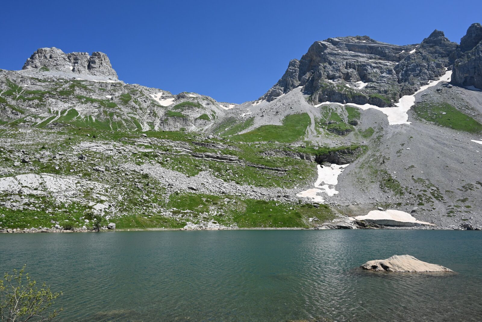
On the Albanian side of the same range, in the karst landscape north of Maja Jezercë, the highest peak of the Accursed Mountains, lie the Buni i Jezercës lakes. The biggest, the Great Lake, is the highest large lake in the Albanian Alps, and they sit in a high rocky bowl that holds water through much of the summer, but not all of it. In the Valbona–Theth country you are as far from a road as the Balkans allow.
The walk from the Valbona valley is about 10 km, with some 1,200 m of climbing to a pass and an off-trail descent to the lakes, in about five to seven and a half hours without breaks. It is technically straightforward but challenging, and you need a GPS track and proper boots. There is no water between Kukaj and the lakes, and the only spring is on the eastern shore of the highest lake. A return in one day is possible but intense. Camp at the lakes, then walk back or continue over the Peja pass to Theth the next day.
- What makes it unusual
- A chain of remote alpine lakes in karst, at the foot of the highest peak of Prokletije.
- Getting there
- On foot from the Valbona valley, or, as the easiest approach, from Vusanje in Montenegro.
- Best time
- Summer, when the snow has gone from the pass.
- Mind this
- Carry all your water up from Kukaj, and check border and permit rules if you approach from Vusanje.
This is a trip for experienced walkers, and it is better done as two days than one. Sleep by the water, and you will have the Great Lake to yourself in the evening light.
Full profile: Liqeni i Madh i Jezercës
The Blue and Red lakes of Imotski: pits that fill and empty
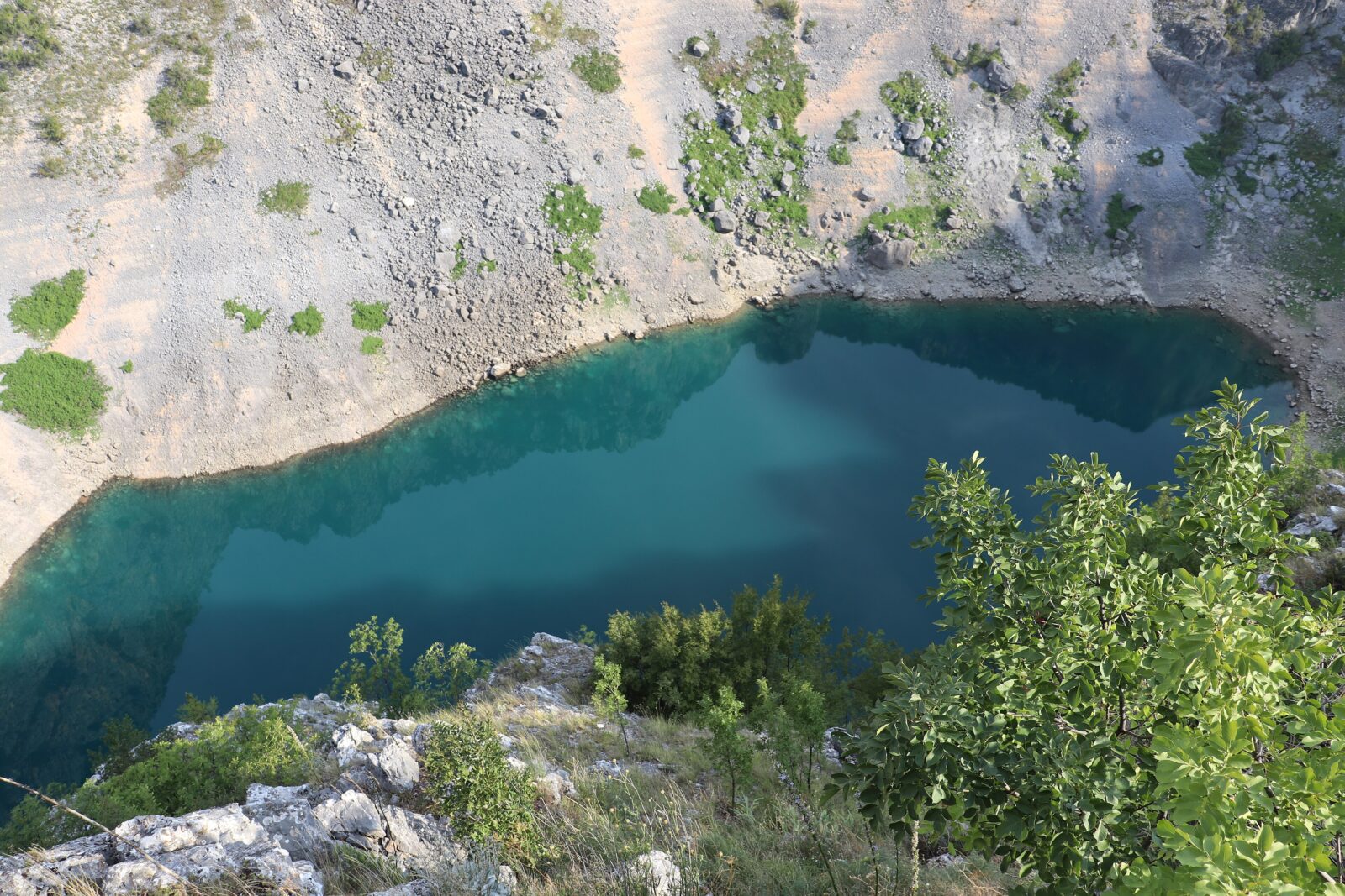
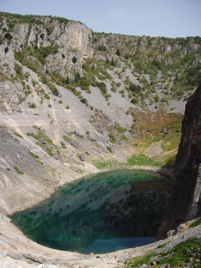
The limestone hinterland of Dalmatia hides some of the strangest lakes in the Balkans. Blue Lake lies in a deep sinkhole right beside the town of Imotski in southern Croatia, probably formed when the roof of a huge cave collapsed. Its level changes enormously through the year. It fills with meltwater in spring, and in 1914 it rose so far that it overflowed its southern rim. By the end of a hot summer it can disappear completely, and when it does, the lakebed becomes a football pitch where local teams with names taken from folk tales play.
The trail leads all the way down to the water, and in most summers there is enough for a swim. The Topana fortress, which stands on the rock above the lake, was an Ottoman stronghold from 1493 to 1717 and gives you a view of the town and the lake. Check the water level before you go.
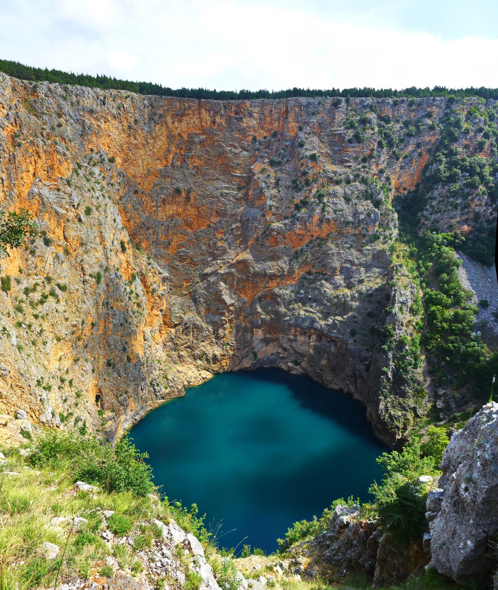
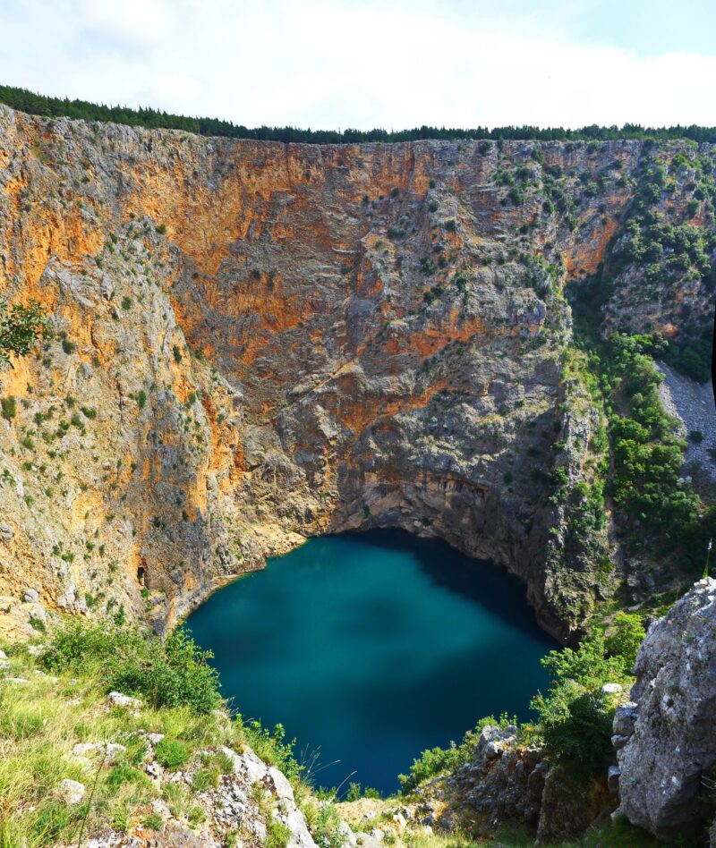
Red Lake is another sinkhole about 1.5 km from the town centre, with reddish-brown cliffs coloured by iron oxides rising high above the water and continuing far below it. Swimming is not allowed, and the cliffs are steep, so keep well back from the edge. In 2017 a French cave diver became the first person to reach the bottom. Two fish found nowhere else, the spotted minnow and the Imotski spined loach, live in the lake. A local legend says an arrogant woman defied God, and her house, the Gavan palaces, vanished into the abyss and left the lake in its place.
- What makes them unusual
- Karst sinkholes, one of them seasonal, in the same town.
- Getting there
- Imotski is just over an hour by road from Split; Blue Lake is within walking distance of the centre, and a walking route links both lakes.
- Best time
- Spring, when Blue Lake is full. In some years it is dry by late summer.
- Mind this
- Swim only in Blue Lake. Stay behind barriers at Red Lake.
Drakolimni of Tymfi: the dragon lake
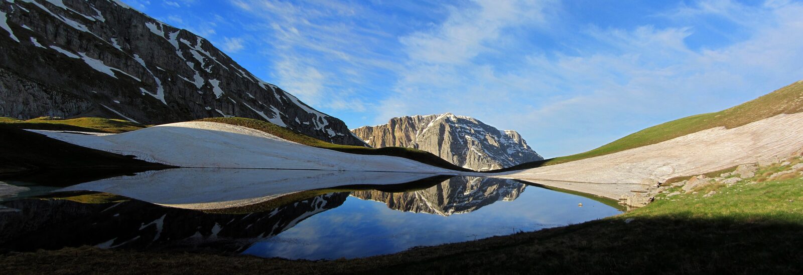
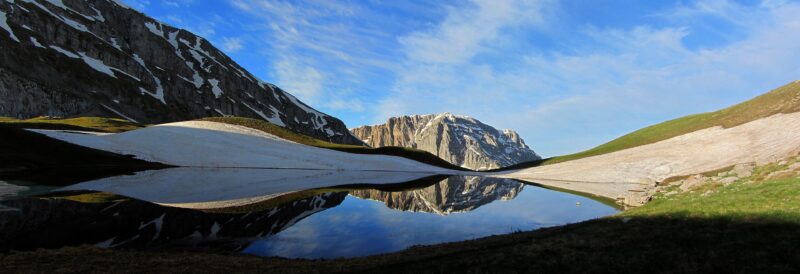
The Greek word means Dragon Lake, and the story fits the place. Local folk tales say that dragons once lived in the lakes of this region and fought each other by throwing pines and rocks, which is how they made the rugged landscape. The best-known Drakolimni is on Tymfi, in Vikos–Aoös National Park in Epirus, below the peaks of Ploskos and Astraka. A species of alpine newt lives in it, and on the other Drakolimni, on Smolikas a few kilometres to the north, as well.
The usual route climbs from the village of Papingo to the Astraka refuge, at about 1,950 m, and from there it is about 50 minutes to an hour to the lake. The peak of Gamila stands behind it. The hike is demanding and needs experience and good fitness. A longer itinerary crosses the Vikos Gorge first and climbs the north-west side towards Mikro Papigo.
- What makes it unusual
- An alpine lake of dragon folklore, home to alpine newts.
- Getting there
- On foot from Papingo, by the Astraka refuge, a walk of several hours.
- Best time
- Summer and early autumn, once the snow has gone.
- Mind this
- Prepare for alpine weather, and check the national park's rules and trail conditions before you set out.
Vikos–Aoös National Park receives more than 100,000 visitors a year, but almost all of them stay down in the gorge. Up here, you will have far fewer companions.
Full profile: Drakolimni Tymfis
A word of care
Several of these places are protected: the floating islands, the tortoise island and the high reserves all depend on visitors keeping to the paths and not landing, picking or feeding. Water levels at Mavrovo, Imotski and the Prokletije lakes change with the season and the year, so a lake that was brimming in a photograph may be low or dry when you arrive. Check locally before you travel, and take extra care in the mountains.
Where to start
For an easy detour with a big payoff, drive to Mavrovo or Imotski. For a weekend of wildlife and quiet, choose Vlasina or Golem Grad. And if you want a proper adventure, the lakes of Prokletije and Tymfi are waiting at the end of a long walk.